|
|
Post by enigmas on Jul 22, 2018 7:46:58 GMT
Having time up our sleeves and with winter biting in OZ Victoria, Marion and I thought we'd take a break from Melbourne's current dreary weather and go on a road trip to Perth in Western Australia. Heading first from the SE suburbs of Melbourne to Adelaide (SA) then across the Nullarbor (latin: no trees) and finally on to the coastal beaches of southern WA and then Perth. On average, especially whilst crossing the 'Great Australian Bight', covering 500 - 600 kms per day. Here are a few pix of the way over. A Painted Silo at Kimba South Australia 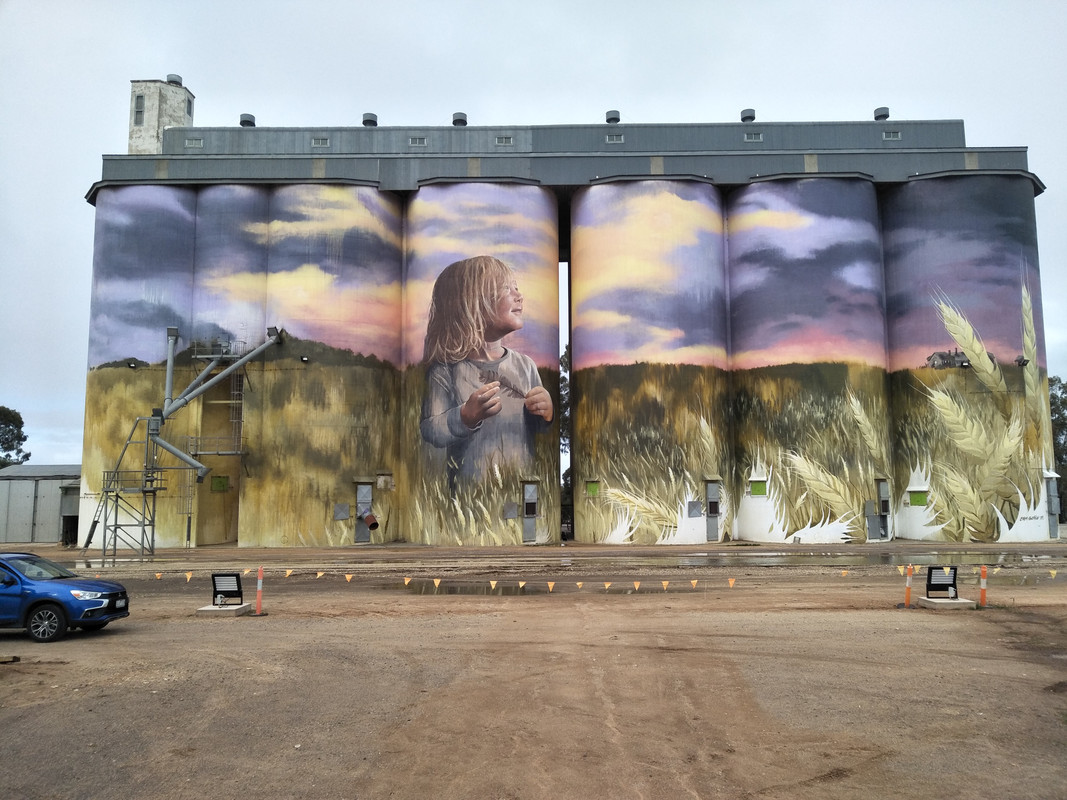 The road ahead. 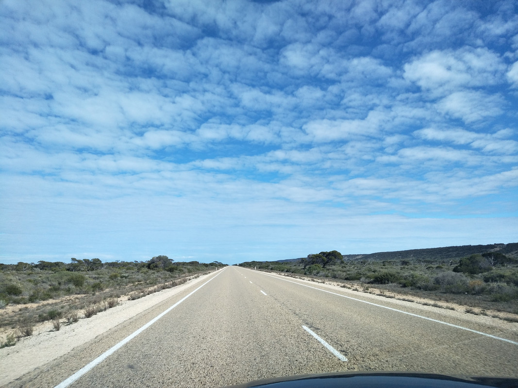 Note the Navman (Satnav) map guide! 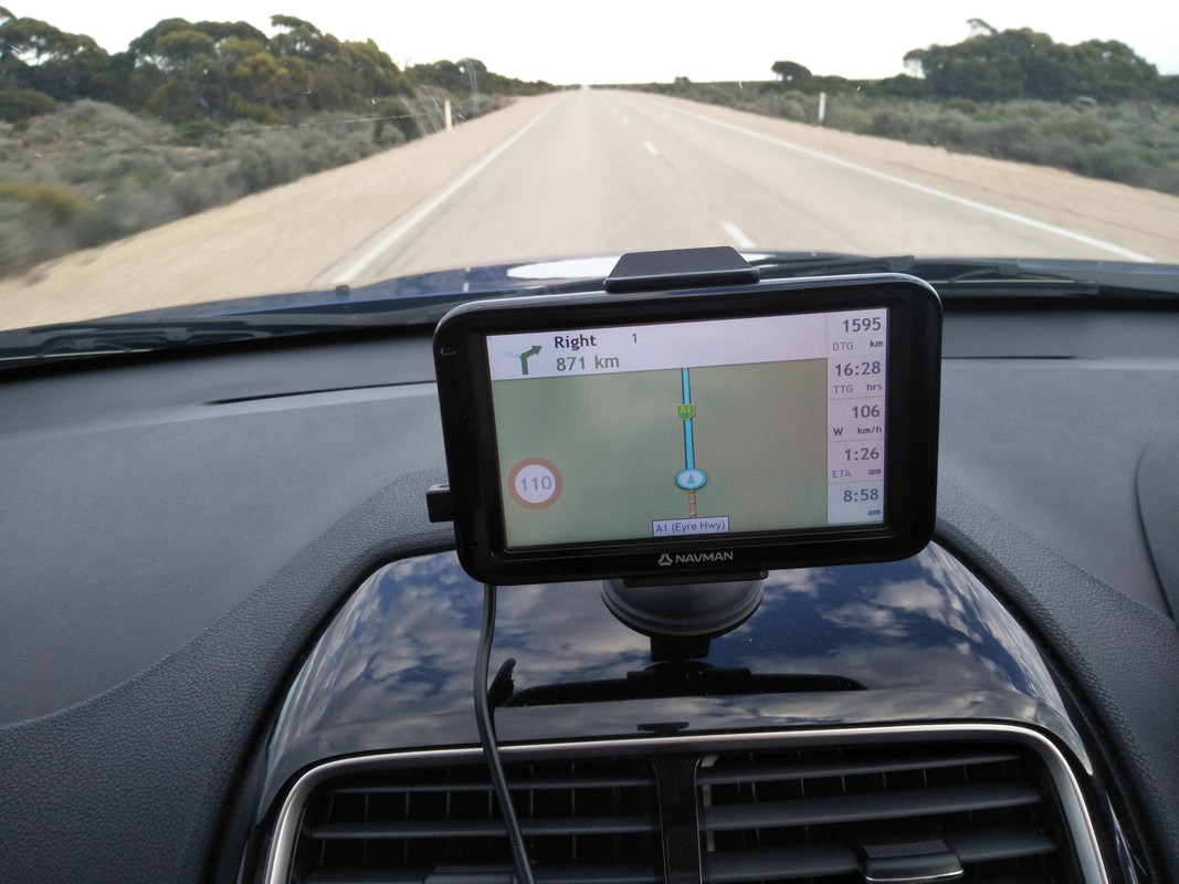 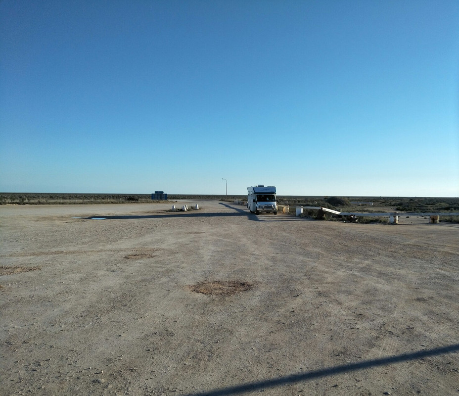 The fuel stop at the Nullarbor Road house. 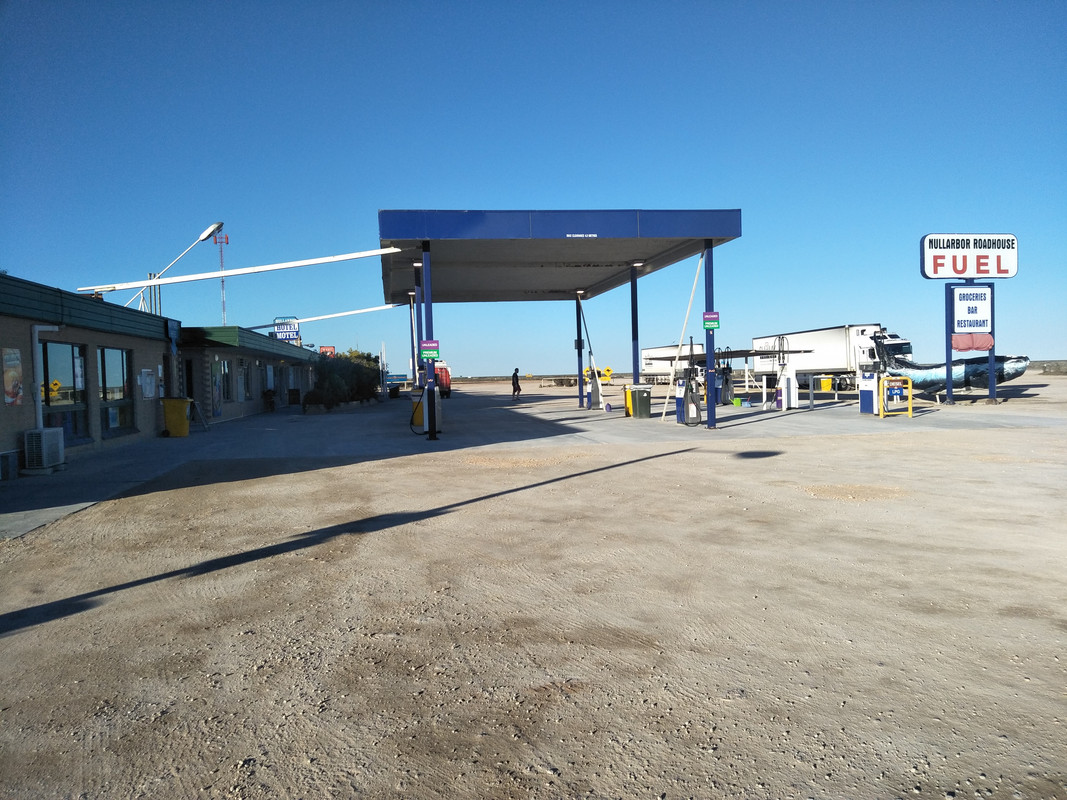 A view of the Southern Ocean. 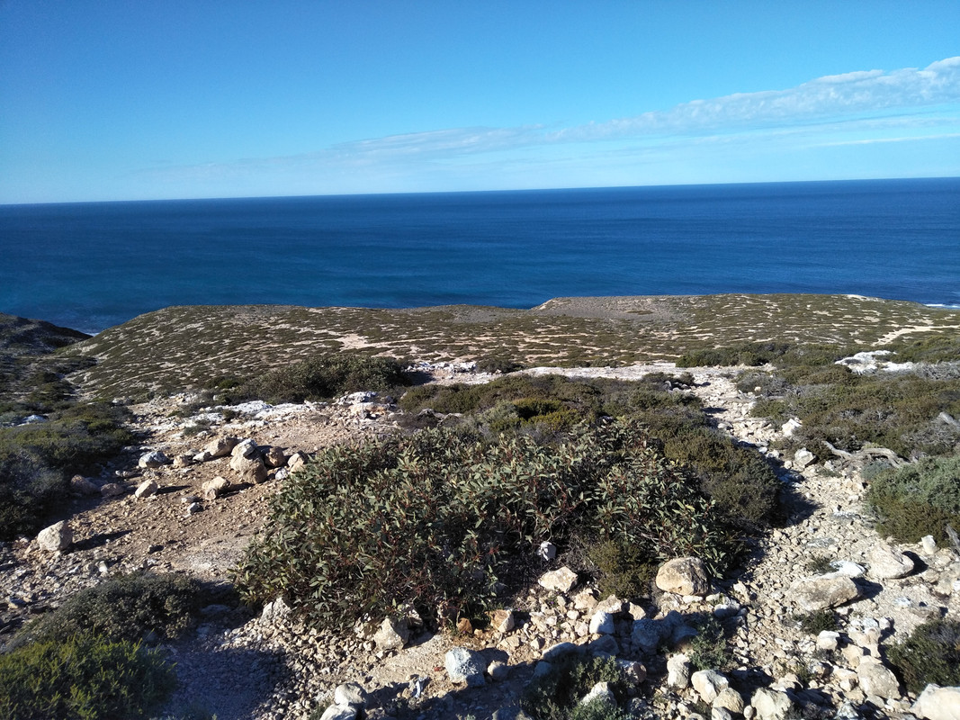 The Nullarbor roadhouse is situated between the East and the West of these places. 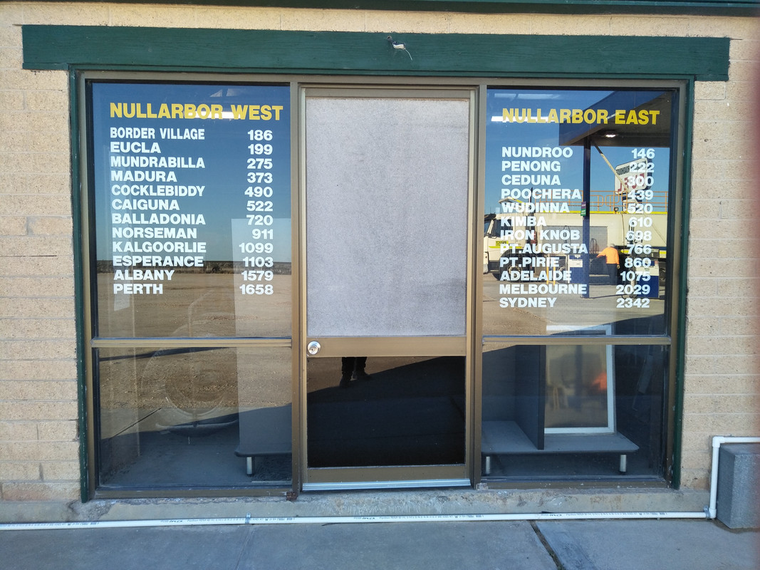 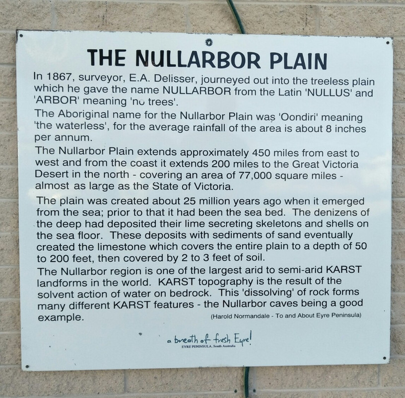 |
|
|
|
Post by Warwick on Jul 22, 2018 9:23:47 GMT
What's going on here, Vince! This does NOT look like the dashboard of a P5, or even a Magnette! |
|
|
|
Post by enigmas on Jul 22, 2018 12:45:52 GMT
Very astute Warwick...I wouldn't be game enough to drive either of my classic cars over these sorts of distances without a tight knit small convoy of enthusiasts. The distances between towns or even road houses is too great..not like Europe.
If you've ever driven along the Eyre highway across the Nullarbor with the almost endless straight road to the horizon you'd understand. Nothing like hitting a stray camel if you're night driving.
Note the Navman in the pics above... a seemingly endless straight line with nothing on either side. You won't see that in too many countries!
|
|
|
|
Post by Warwick on Jul 22, 2018 13:04:24 GMT
|
|
|
|
Post by enigmas on Jul 22, 2018 13:44:46 GMT
Very brave Warwick...looks like a Peugeot 404.
|
|
|
|
Post by Warwick on Jul 23, 2018 6:20:45 GMT
Not really, Vince. The 404 was built for conditions like that; and much worse. 45 years ago, this year. I was Hamish's age and my last trip with the family, after many long touring trips since I was a kid. I flew over and met them in Perth, then toured around the bottom half of WA and drove back across the Nullarbor with them. Mum, Dad, and my two younger brothers. Those were the days. |
|
|
|
Post by OlafR on Jul 23, 2018 7:07:51 GMT
Is it that you like bigger figures, or why is the SatNav showing km instead of mi?  Cheers, Olaf |
|
|
|
Post by Warwick on Jul 23, 2018 7:58:58 GMT
Is it that you like bigger figures, or why is the SatNav showing km instead of mi? Cheers, Olaf Probably because we've been using the metric system since 1974, Olaf.  (Decimal currency since 1966) Although thanks to the Chinese assuming that all English speaking markets are the same as America, we again have products for sale, such as nuts, bolts, and TV sets, packaged with Imperial measurements. |
|
|
|
Post by OlafR on Jul 23, 2018 8:11:36 GMT
Is it that you like bigger figures, or why is the SatNav showing km instead of mi? Probably because we've been using the metric system since 1974, Olaf. (Decimal currency since 1966) Although thanks to the Chinese assuming that all English speaking markets are the same as America, we again have products for sale, such as nuts, bolts, and TV sets, packaged with Imperial measurements. Gee, I didn't know that. Since the sign in your picture showed miles and feet I thought that you'd still be on imperial measurements. Learn something new each day!  Cheers, Olaf |
|
|
|
Post by Warwick on Jul 23, 2018 9:05:34 GMT
I didn't read the sign, Olaf. It's either a very old sign, or it's been replaced with one identical to the original. I suspect it's the latter.
|
|
|
|
Post by Eric R on Jul 23, 2018 10:32:41 GMT
i expect the Sat Nav being an international product can be set to miles or kms, as it is for language and voice etc. Didn't Australia change to metric in 1974? Its hard to comprehend the reality of Australian distances anyway. What do u do in the event of a breakdown - phone the Flying Auto-Doctor service? Amazing photos.  |
|
|
|
Post by Warwick on Jul 23, 2018 11:23:41 GMT
Not sure of the level of traffic these days Eric. Vince will be able to answer that when he's next on line. But back in 1973 when I travelled across, there were road-trains travelling in both directions throughout the day. In fact it paid to get right off the road when you saw one coming and wait until it passed, so as to avoid being showered with rocks.
A couple of things you'll notice in my father's old photo. There are stone-guards protecting the windscreen, grille, and headlights. And the row of rocks down each side of the road. Because it was unsealed, the heavy road-trains would wear away the gravel and expose the larger stones underneath. Graders regularly worked their way back and forth along the length of the highway, regrading the surface and moving the exposed rocks to the side. But there is a limit to how often you can do this before you create a lower road surface. Therefore, every so often they would simply grade a new road beside the old.
Regarding your comment about comprehending these distances. During the '80s and half the '90s, I worked for BOC Gases' Australian subsidiary. We had the largest transport fleet in the country that wasn't specifically a transport company. We could deliver gas cylinders anywhere in the country. Periodically we would have visitors from BOC in the UK, or the US subsidiary, Airco. It was interesting when the subject of product distribution arose. The British visitors had difficulty comprehending the distances involved, while the Americans understood the distance but not the fact that there was a lot of empty space in between major cities.
I'm looking forward to Vince's next batch of photos.
|
|
|
|
Post by enigmas on Jul 23, 2018 13:02:00 GMT
i expect the Sat Nav being an international product can be set to miles or kms, as it is for language and voice etc. Didn't Australia change to metric in 1974? Its hard to comprehend the reality of Australian distances anyway. What do u do in the event of a breakdown - phone the air Auto-Doctor service? Amazing photos. Hi Eric...due to our travel agenda...6 consecutive days now and finally settled into decent accommodation in Esperance, a coastal town south of Western Australia, it's been difficult to post updates with regularity due to the lack of signal at some stages. As for breaking down...it can be diabolical along the Eyre Hwy due to the vast stretches of distance between roadhouses (large petrol stations with motel accommodation) These places can still be described as rustic and basic...even today. They are very isolated and generate their own electricity (diesel powered generators) to run a desalination plant purifying salty bore water. So costs for both accommodation and fuel is expensive, $2.08 per litre and $160 for a motel room (with snake & vermin if unlucky) There's a poster on the door of the motel room at the Nullarbor roadhouse illustrating the types of snakes that may get into a room if the door is forgetfully left open...further advising that you shouldn't handle the snake and to stay calm whilst calling for assistance. Temperatures at the height of summer can reach 50C along the Nullarbor. So it's best to be prepared and consider what your doing when travelling along this route. Overseas tourists driving old, poorly maintained cars can get themselves into diabolical circumstances underestimating the reality of the crossing. At one stop along the way at Belladonia...a guy had been stranded in the driveway (dirt not paved) for 24 hrs when his diesel van broke down. He had no breakdown insurance/roadside assist coverage and was quoted over $1000 for a recovery vehicle to come and tow his car. The recovery vehicle needed to come from Norseman over 200kms from the roadhouse at Belladonia...there is absolutely nothing in between the 2 spots apart from open space, low shrubs and kangaroos, emus, camels and wild horses. Not that you see many...unless you hit one. It's very odd seeing sign posts with profile pictures of these animals as road hazards! Some sections of the highway (simply a 2 lane road) have a sign posted stating that aircraft may use it in cases of emergency! |
|
|
|
Post by Warwick on Jul 23, 2018 13:34:04 GMT
... What do u do in the event of a breakdown -.... Eric, following on from Vince's answer to your breakdown question, I probably should add a bit more to my answer about what it was like 45 years ago. My reference to the passing road-trains was to explain how you could summon help if stranded in a remote area in the days before mobile phones or citizen band radios were available. The road-train driver could be flagged down for assistance, but he could do little more than carry a message to the next outpost. Recovery or breakdown assistance would have to come to you from far away (if you were unlucky), as Vince has described. |
|
|
|
Post by Warwick on Jul 23, 2018 13:45:45 GMT
...there is absolutely nothing in between the 2 spots apart from open space, low shrubs and kangaroos, emus, camels and wild horses. Not that you see many...unless you hit one. ... We were lucky on our trip, Vince. The only close call was when an emu ran across the road in front of the car. The only reason we didn't hit it was because it tucked its bum in just at the last minute. If it hadn't done that, it would have smashed the left-hand front corner of the car. And if it had been a split second slower, we would have taken its legs out from under it and it would have come through the windscreen, stone-guard and all. This wasn't on the Nullarbor, but on the better sealed road heading north to Carnarvon, so we were travelling much faster. If you aren't already planning to do so, make sure you take the time to climb Frenchman's Peak. |
|
|
|
Post by p5bdownunder on Jul 25, 2018 5:26:46 GMT
Photos look great, Vince.
Looking forward to catching up with you again next week, but this time in Fremantle!!
Drive safe...
Stu
|
|
|
|
Post by vincentacres on Jul 25, 2018 11:28:34 GMT
Nice trip Vince 👍🏻 But timing could be better as I’m
currently enjoying the cold in Canberra! Enjoy your time in the West!
|
|
|
|
Post by enigmas on Jul 26, 2018 8:20:34 GMT
Nice trip Vince 👍🏻 But timing could be better as I’m currently enjoying the cold in Canberra! Enjoy your time in the West! PM sent Owen. |
|
|
|
Post by enigmas on Jul 26, 2018 12:11:54 GMT
Here's a couple more pix from our travels west. Old pier at Esperance (Western Australia)... obviously a coastal town. 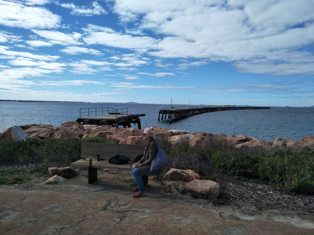 Partial view of the Great (Southern) Ocean Drive from Esperance WA. 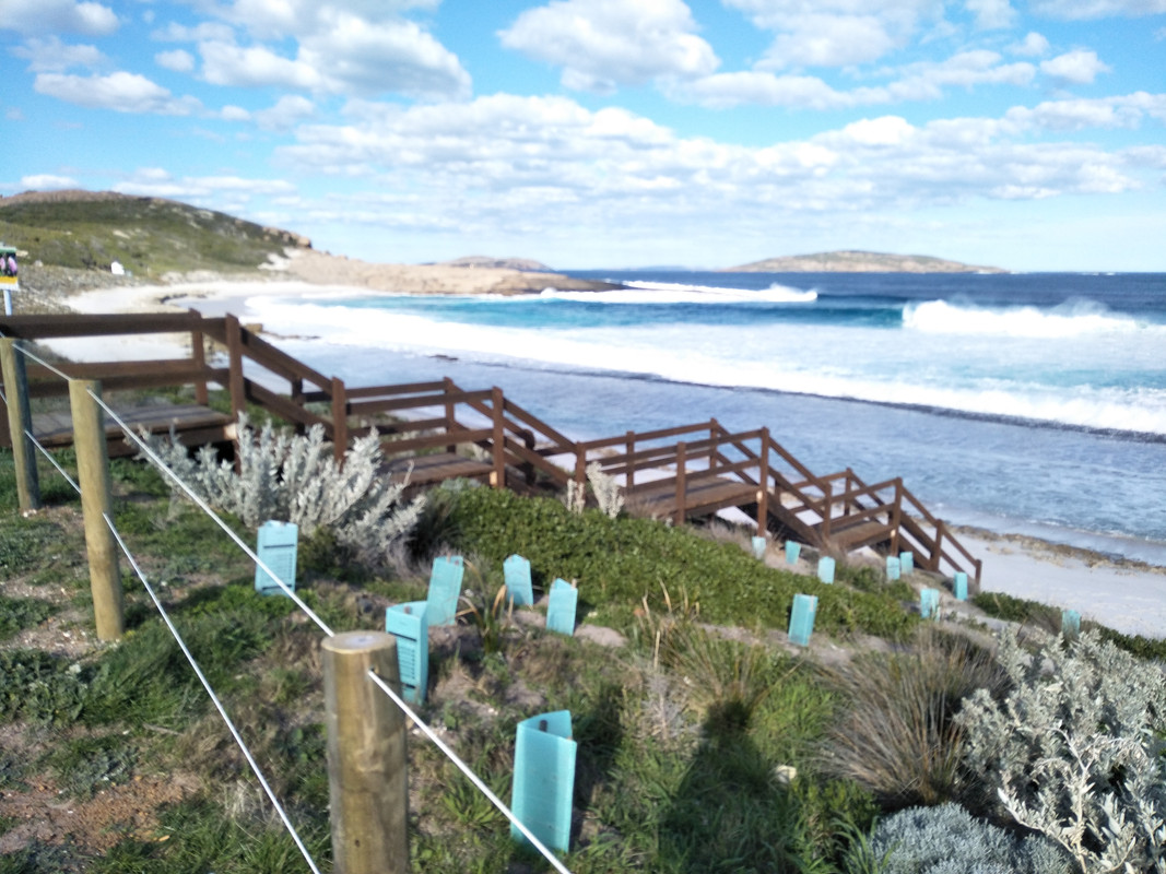 The Pink Lake at Esperance WA 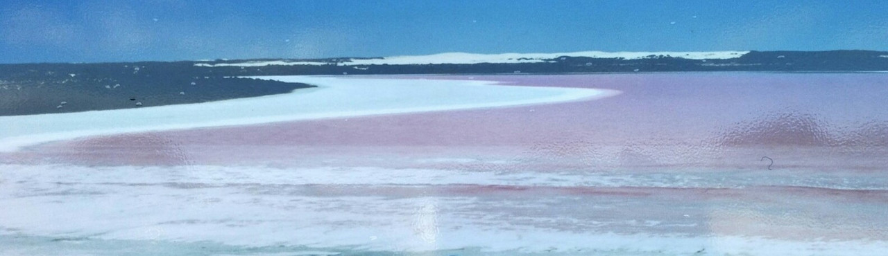 2 views of the Munglinup Roadhouse on the road to Albany. 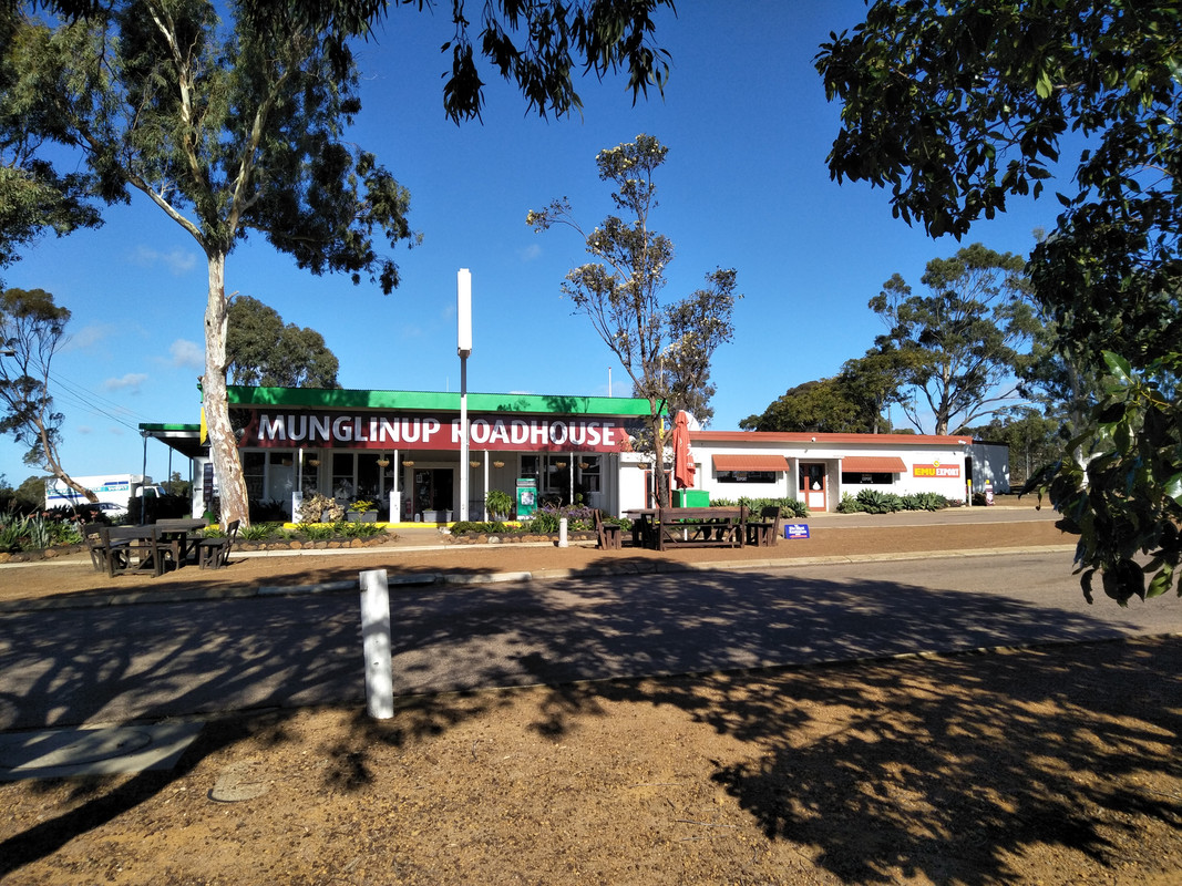 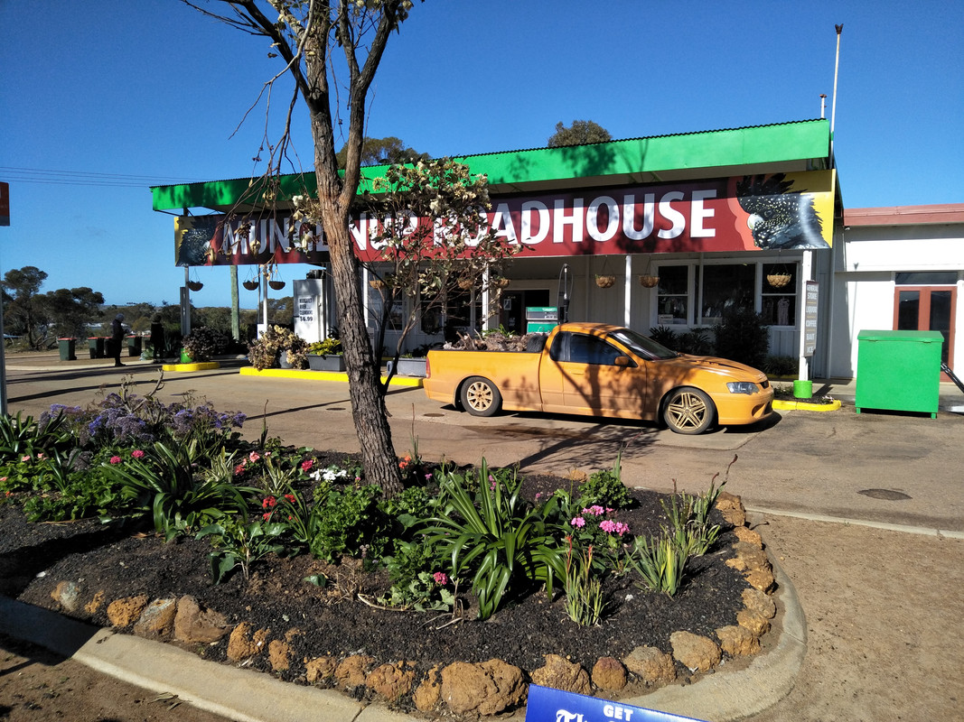 A view of the Middleton beach in Albany WA. Note the 'tanker' in the extreme RH corner of the picture. 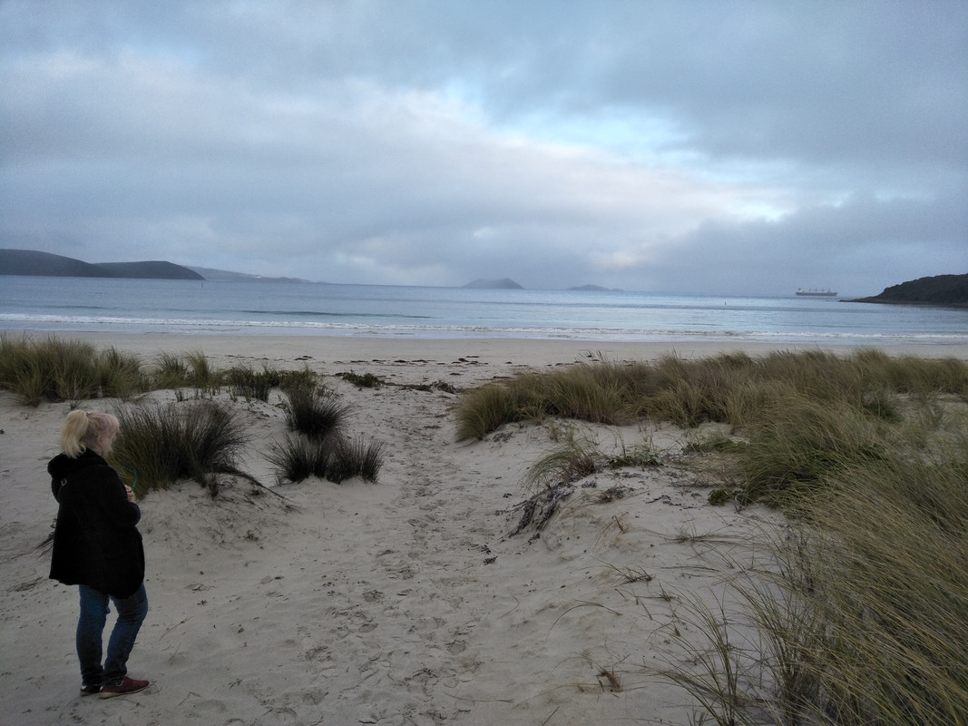 |
|
|
|
Post by enigmas on Jul 27, 2018 0:24:56 GMT
Here's a map we were given by the manager of the motel at Port Wakefield, South Australia. Port Wakefield is 728 kms from the Melbourne CBD approximately 15 kms from our home. The map below shows the distance covered so far (excluding the road trip (728kms) from Melbourne, Victoria) to our current stay at Albany, off the south coast of Western Australia. From there we drive to Margaret River situated west, off coastal WA, and then head north up to Perth where we load the car and board the Indian Pacific, a train that runs from Perth to Adelaide. The train line the Indian Pacific runs along can be seen on the Map marked in yellow. It's quite an expanse. 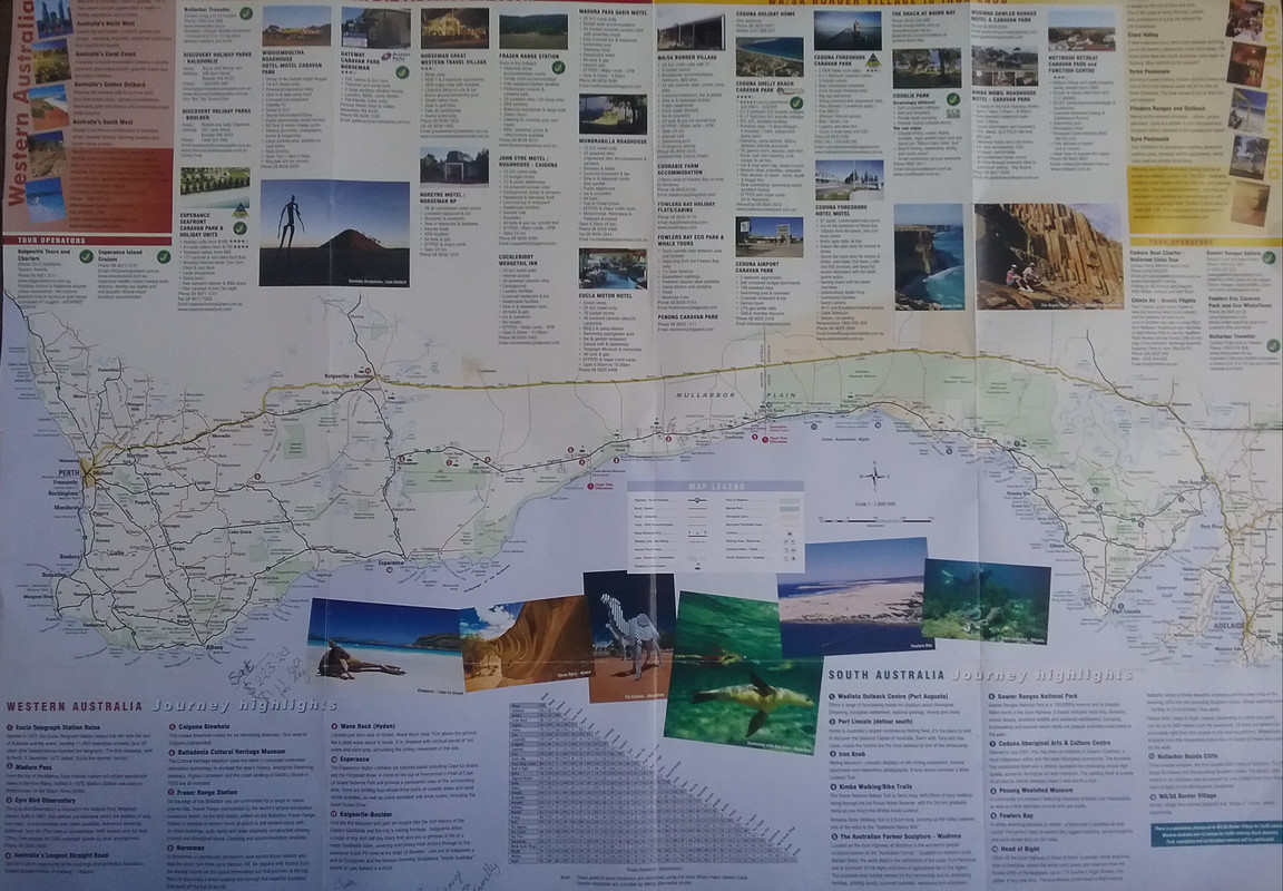 |
|
|
|
Post by enigmas on Jul 27, 2018 11:35:44 GMT
As with any road trip, considerable time is inevitably spent travelling in the car. Due to the vast stretches of open, uninhabited land along the Nullarbor section of the Eyre Highway, (Ceduna to Norseman c.1194 kms) we wanted to ensure that we arrived at secure destinations with suitable accommodation at the end of each day's travel. Of course, if we were towing a van...there are plenty of 'isolated' rest areas to pull over and set up for the night! Unfortunately, being a city/urban dweller for most of my life, (and having an active imagination) this option really didn't bode too well with me. Once the Nullarbor expanse had been traversed though, our travelling became much more leisurely with planned stops at various coastal towms for 1 - 2 days exploring the local attractions. Here are some pix of Albany most of them taken during a 10 km coastal walk into town and back today. A view of the road leading into Albany. 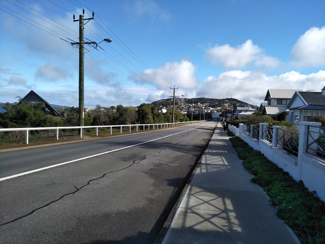 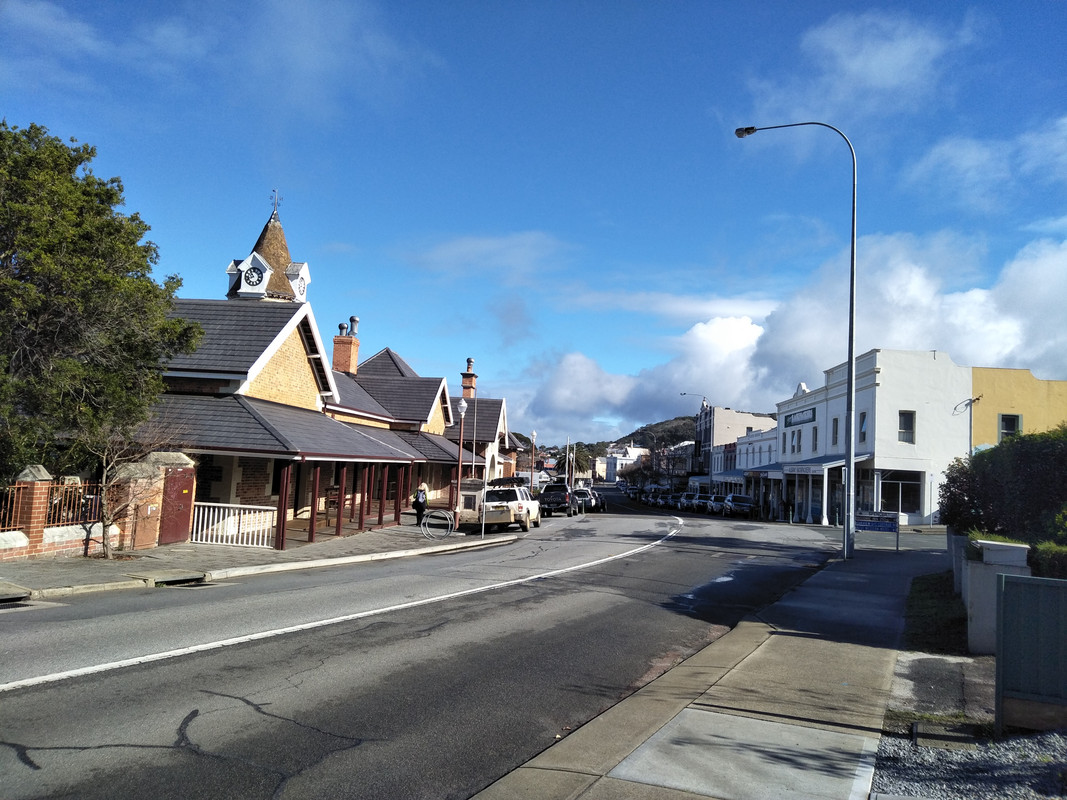 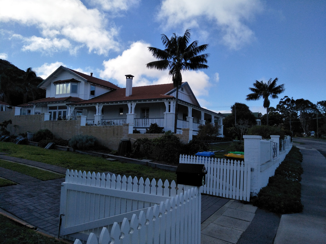 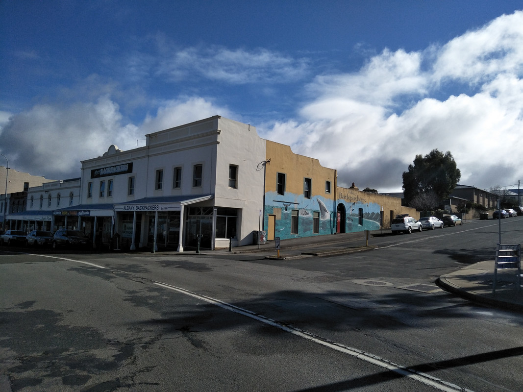 Albany Town Hall. 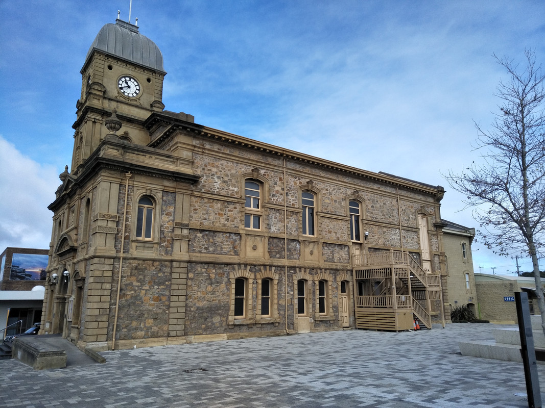 Albany Masonic Lodge 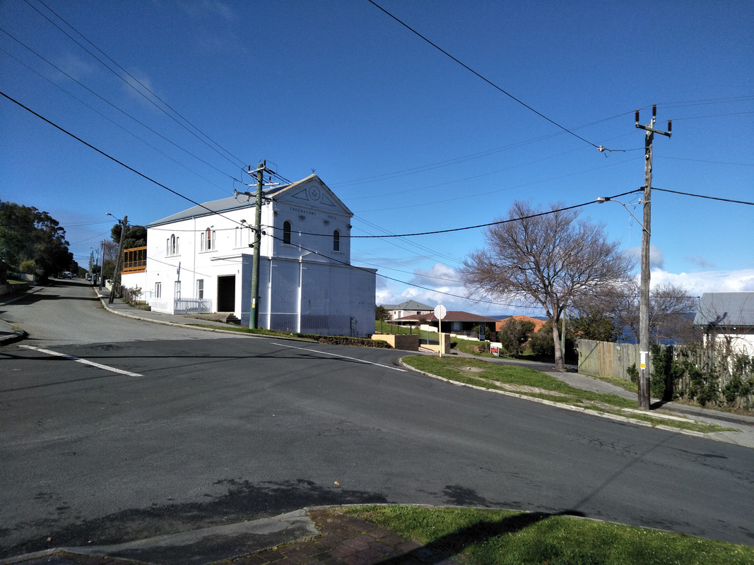 |
|
|
|
Post by Warwick on Jul 28, 2018 9:55:51 GMT
... Here are some pix of Albany most of them taken during a 10 km coastal walk into town and back today. ... Incredible, Vince. 45 years since I was there and it looks as I remember it. |
|
|
|
Post by enigmas on Jul 28, 2018 12:46:56 GMT
It is the 'west' Warwick...and the roadhouses, outback motels and coastal towns do have a 1960s Aussie ambience about them. The historic buildings as you know hark back to British colonisation and they still remain.
PS. We arrived at Margaret River this afternoon and will post some photos tomorrow.
For those reading this post who are not aware of 'Margaret River' you may very well have enjoyed a bottle of wine produced in this region. The town and region is known for its wineries, boutiques, surf beaches and limestone caves to name a few attractions.
|
|
|
|
Post by Warwick on Jul 28, 2018 13:32:25 GMT
And every second place name ends in ...up.
|
|
|
|
Post by enigmas on Jul 30, 2018 12:35:12 GMT
We spent 3 days at Margaret River. Here are a few pics of some of the sights on offer. Stopped at 'Witchy Pies', Witchcliffe a small rural town just out of Margaret River for lunch. (Only in OZ!) 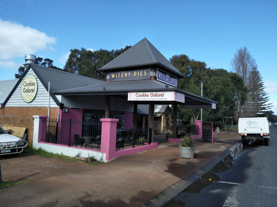 ...and then did a bit of caving... 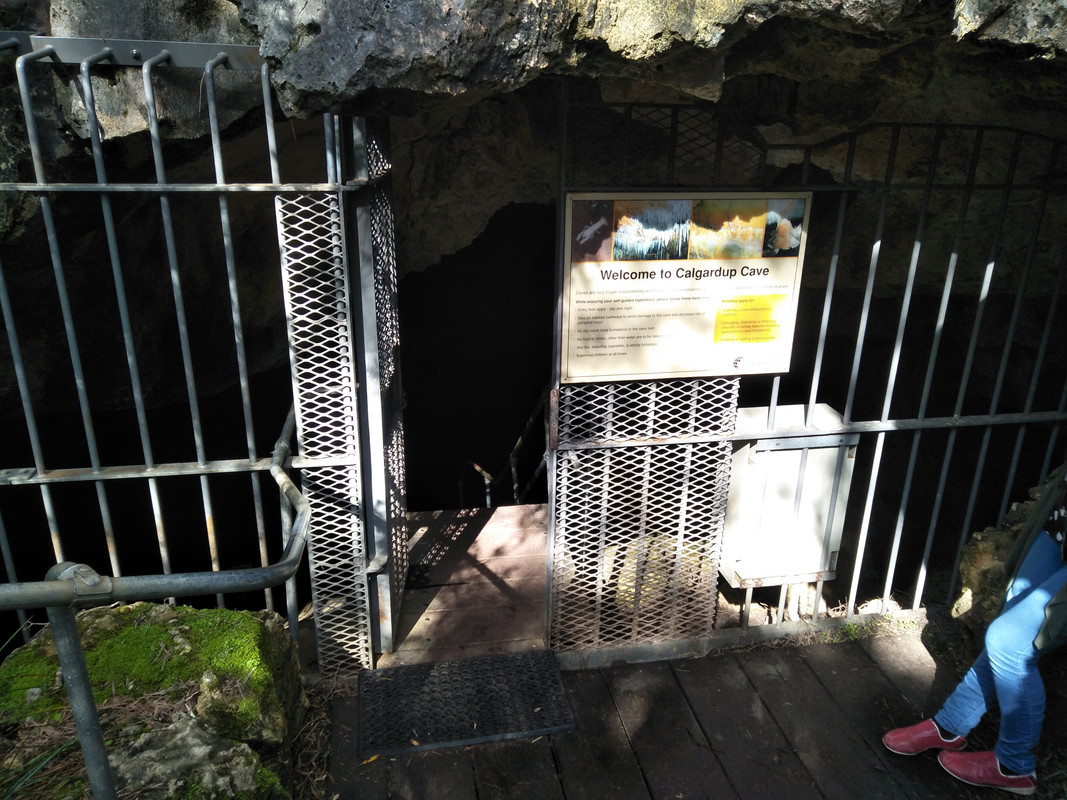 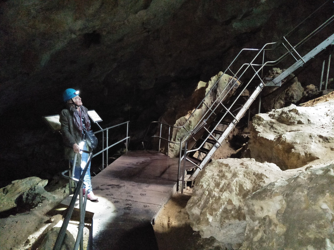 Then went to the surf beach at the mouth of Margaret River. Note the sign and the warning about Sharks! Swimming here at Margaret River is purely for thrill seekers as sharks find their way up the river. 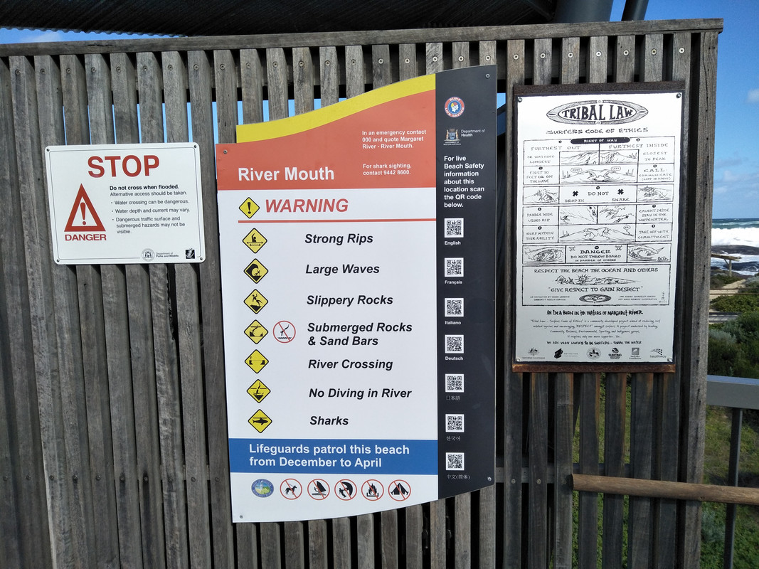 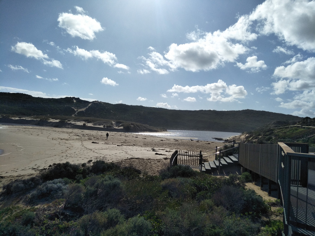  A notice to the surfing community. (The term 'grommets' is a colloquial term used to describe young surfers. See below) 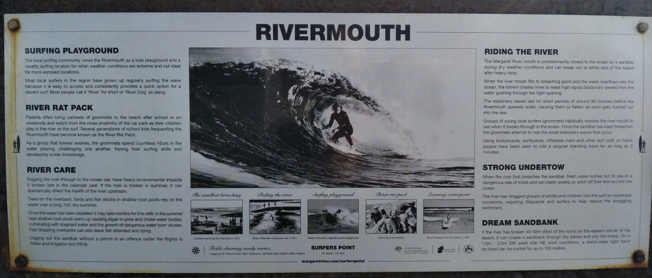 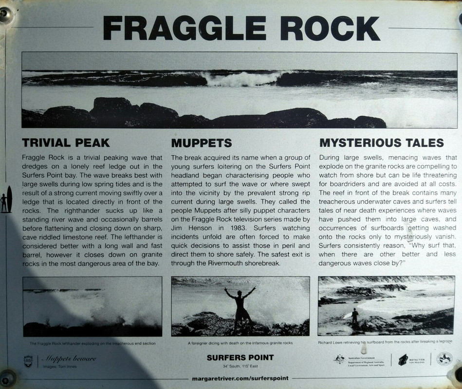 An beach inlet and cafe at 'Gnarabup'...a short drive from the river mouth. 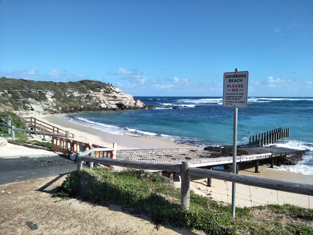  ...and last but not least, a solitary charging station for your Tesla a short walk from our motel. PS. I have no idea how long it would take to recharge an electric powered vehicle? 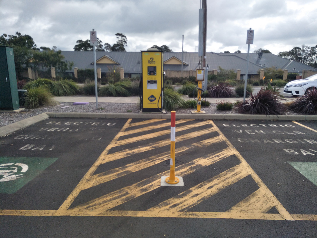 |
|


 (Decimal currency since 1966)


